
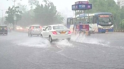
Bhubaneswar: A Low Pressure Area (LPA) has formed over Odisha and neighbourhood under the influence of the cyclonic circulation over northwest & adjoining westcentral Bay of Bengal off south Odisha north Andhra Pradesh Coasts which extends up to 7.6 km above mean sea level tilting south westwards with height, informed the India Meteorological Department (IMD) today. Under the impact of the Low Pressure Area light to m o d e r a t e r a i n o r thundershower is very likely over most parts of the districts Odisha with isolated heavy to very heavy spells in some places over the next five days, the IMD has predicted. The weather agency has issued orange and yellow alerts respectively for the districts likely to experience heavy to very heavy spells of rain. Here’s the IMD’s heavy rainfall warning for the next five days: Day-1: (Valid up to 0830 Hrs ISTof 10.07.22) Or a n g e wa r n i n g (Be prepared): Heavy to very heavy rainfall is very likely to occur at isolated places ove r the distri c ts of Kandhamal, Nawarangpur, N u a p a d a , K o r a p u t , Rayagada, Malkangiri and Bargarh. Impact: i) It may trigger landslides in vulnerable hilly areas ii) Temporarily water logging in low-lying areas and some damages to Kutcha road iii) Keep arrangement for drainage of excess water. Ye ll ow Wa r n i n g (Be updated): Heavy rainfall is very likely to occur at isolated places over the districts of Bolangir, Gajapati, Mayurbhanj, K e o n j h a r , A n g u l , D h e n k a n a l , J a j p u r, Sambalpur, Sonepur, Boudh and Kalahandi. Day-2: Valid from 0830 Hrs ISTof 10.07.22 to 0830 Hrs ISTof 11.07.22. Ye ll ow Wa r n i n g (Be updated): Heavy rainfall is very likely to occur at isolated places o
Exclusive
Breaking News
 Trailer JCC General body meeting held at Paradip
 CIPET PPEC Paradip planted 400 saplings during plantation drive week
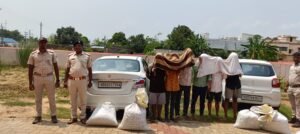
 Excise department seizes 52 Kg Ganja in Major Anti-Drug Crackdown
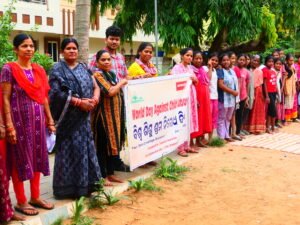
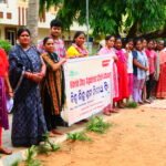 Human Chain to mark World Day against Child labour
 Local appreaciated Patna MLA’s representative efforts, Helpless woman get help


More Stories
Trailer JCC General body meeting held at Paradip
CIPET PPEC Paradip planted 400 saplings during plantation drive week
Human Chain to mark World Day against Child labour