


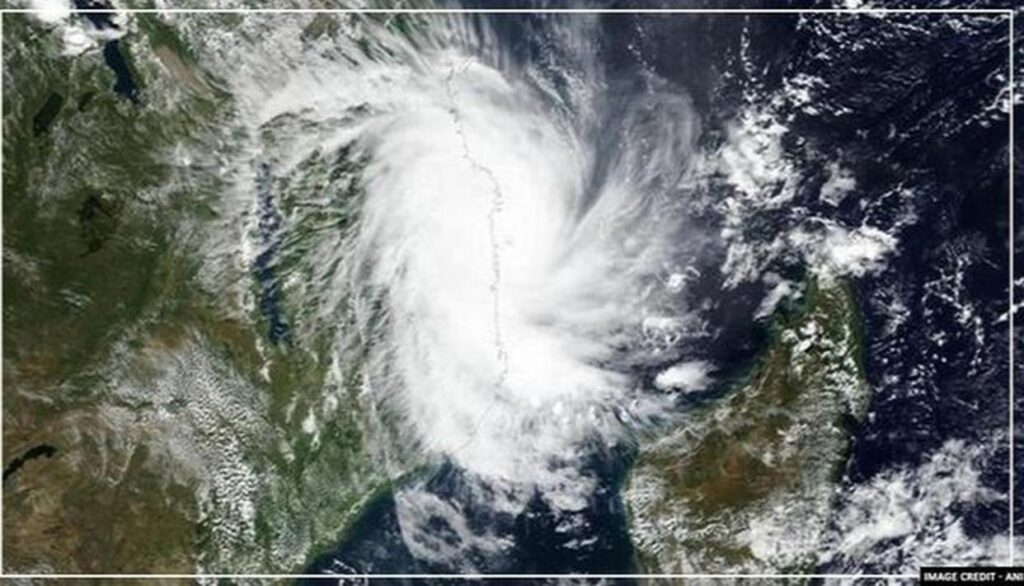
Hyderabad : The well-marked low pressure area over Lakshadweep area & adjoining southeast Arabian Sea moved east-northeastwards, concentrated into a Depression and lay centred at 0830 hours on Friday over Lakshadweep area near latitude 10.5°N and longitude 72.3°E, about 80 km south-southwest of Amini Divi, 360 km west-southwest of Kannur (Kerala), 1170 km south-southeast of Veraval (Gujarat).
It is very likely to intensify into a Deep Depression during next 12 hours and into a Cyclonic Storm during subsequent 12 hours, Meteorological Centre here said in a special bulletin.
It is very likely to intensify further and move initially north-northeastwards till this evening. It would then move north-northwestwards and reach near Gujarat coast by May 18 morning, the bulletin said.
Meanwhile, the Cyclonic Circulation lies over Vidarbha & neighbourhood and extends upto 1.5 km above mean sea level.
The North-South trough/wind discontinuity from the cyclonic circulation over southeast Madhya Pradesh & neighbourhood to south Tamil Nadu across Vidarbha, Telangana and Rayalaseema at 0.9 km above mean sea level has become less marked, the bulletin added.


More Stories
Puri BRICS Disaster Risk Reduction Meeting Opens; Odisha CM Calls for Stronger Global Cooperation
India–U.S. Agricultural Cooperation Gains New Momentum Through Key Dialogue Led by IFFCO Chairman Dileep Sanghani
Bear enters Primary Health Center premises, Video goes on viral