


Sikkim’s East District, which witnessed a massive avalanche that claimed several lives on Tuesday, ranks ninth in landslide density and risk exposure among all districts in the country. According to the Landslide Atlas of India ,released by ISRO’s Hyderabad-based National Remote Sensing Centre, Sikkim witnessed 1,561 landslides between 2011 and 2017, with most falling in the category of event-based landslides triggered by earthquakes or heavy rainfall.
Sikkim’s South District ranks eighth across the country in terms of landslide density and risk exposure. “Himalayas and Western Ghats are highly susceptible to mass movements due to hilly topography and heavy rainfall,” the Landslide Atlas of India said.
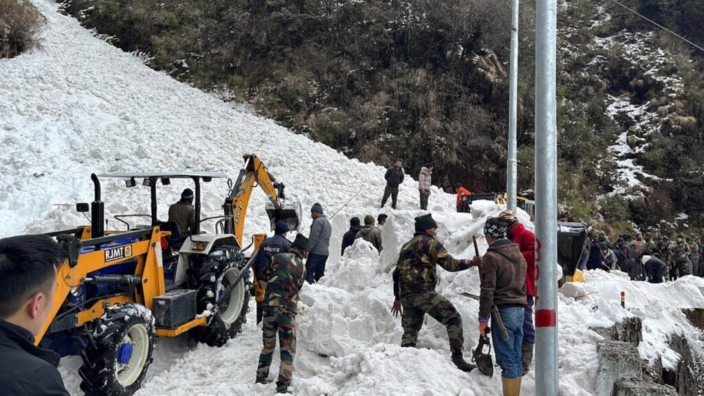
The findings emerged from the latest risk assessment done by scientists from NRSC, which published the list as part of the Landslide Atlas of India. The team released a list of 147 most landslide vulnerable districts in 17 states and two Union Territories. The East District had been experiencing rainfall and snowfall in the higher reaches since Friday, an official from the weather office said. He said the weather office had issued forecasts and nowcasts on rainfall, thunderstorms, and lightning in the northeastern state The weather station at Gangtok, also in the East District, recorded 50 mm rainfall in the 24 hours ending 8.30 am on Tuesday, the Gangtok office of the India Meteorological Department said. Seven tourists were killed as a massive avalanche hit Sikkim’s Nathu La area on Tuesday morning, burying their vehicles under the snow, officials said. Avalanche kills 7 & 150 people feared trapped in Sikkim


More Stories
JSW Utkal Steel holds Plantation Drive & Environmental Awareness initiatives
Climate Change a Looming Catastrophe for the Future; World Environment Protection Week Observed in Nimapada
India–U.S. Agricultural Cooperation Gains New Momentum Through Key Dialogue Led by IFFCO Chairman Dileep Sanghani