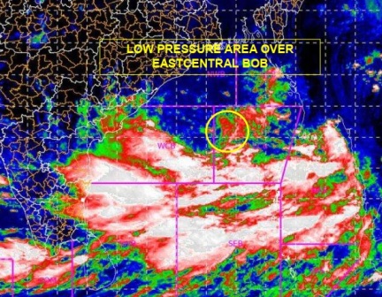
Hyderabad : Under the influence of Cyclonic Circulation over Southeast & adjoining Central Bay of Bengal, a low-pressure Area has formed over East-central Bay of Bengal with associated cyclonic circulation extending up to mid tropospheric levels, Met said here on Saturday.
In a special bulletin, It said it is very likely to concentrate into a Depression over East-central Bay of Bengal on May 23 morning.
It is very likely to move north northwestwards, intensify into a Cyclonic Storm by May 24 and further into a Very Severe Cyclonic Storm during subsequent 24 hours.
It would continue to move North Northwestwards, intensify further and reach North Bay of Bengal near West Bengal and adjoining North Odisha & Bangladesh coasts around May 26 morning.
It is very likely to cross West Bengal and adjoining north Odisha & Bangladesh coasts around evening of May 26, the bulletin said.
The east-west shear zone now runs roughly along latitude 14°N between 3.1 km & 7.6 km above mean sea level.
A cyclonic circulation lies over Marathwada & neighbourhood and extends upto 1.5 km above mean sea level, the bulletin added.


More Stories
Columbia University aakes back Deadline set for Protesters to Leave Campus
BJD Releases List of 3 Candidates for Odisha Assembly Elections
Low vision clinic inaugurated at AIIMS Bhubaneswar